Project Showcase
 |
Map and Aerial Locator Tool (MALT) is a spatially enabled web based application to search for maps and historical aerials in the Fresno State Library. This application is best running in Firefox or Google Chrome browsers. |
|
An interactive map shows Fresno State faculty worldwide collaborations. |
|
 |
An interactive map shows the relationship between median household income and the numbers of bachelor's degree within Cities of Fresno and Clovis Sphere of Influence at Census block group level. |
 |
A PDF map shows Hot/cold spots of Fresno-Clovis Area distressed property sales 2007 - 2012 |
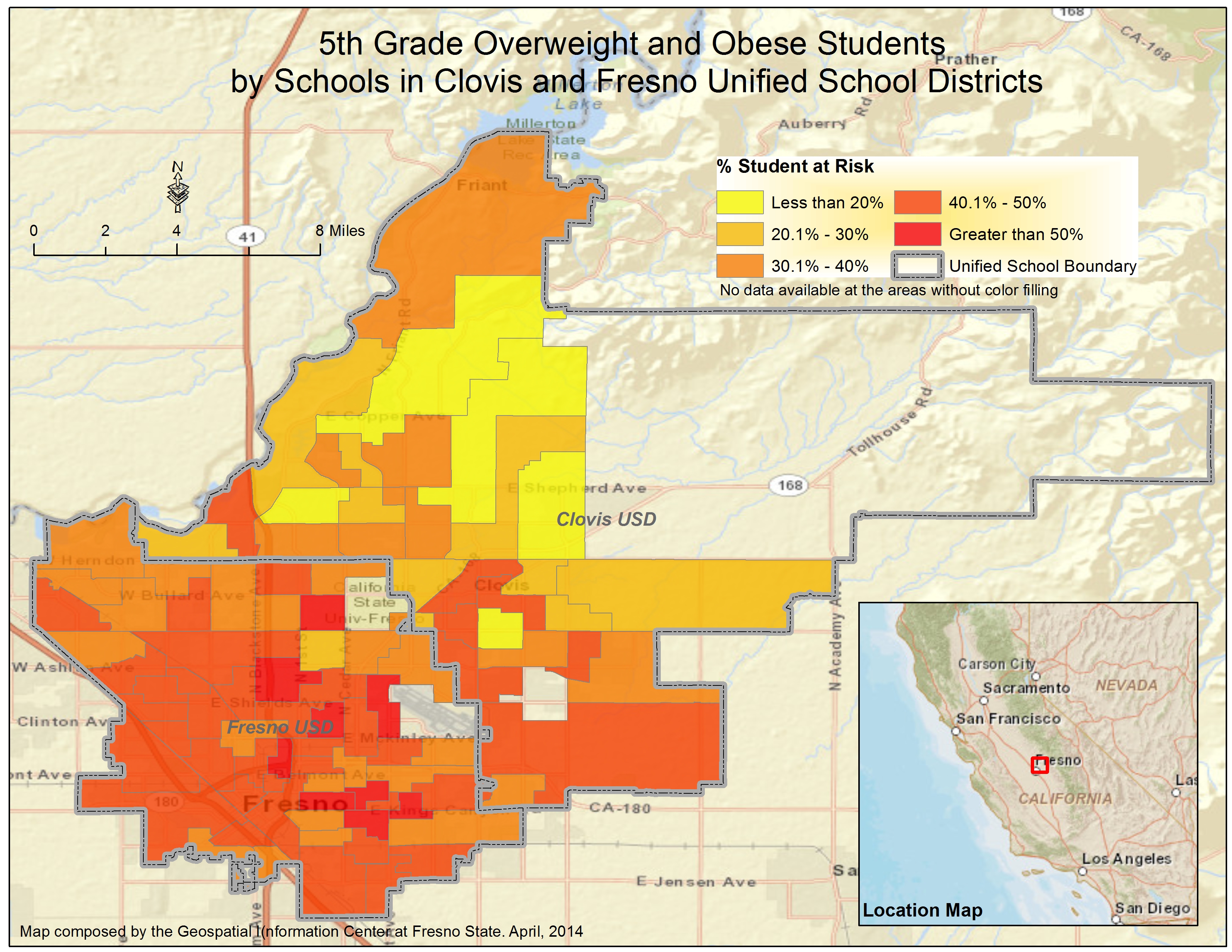 |
A PDF map shows 5th grade overweight and obese students by elementary schools in Clovis and Fresno Unified School districts |
 |
An interactive map shows the depth to ground water from 1970 to current water year, San Joaquin Valley. A swipe tool can be used to compare two different years of depth to ground water. |
 |
3D view of depth to groundwater. 3D Web Viewer requires a desktop web browser that supports WebGL. The latest versions of Chrome and Firefox desktop browsers have WebGL built in. 3D Web Viewer is not supported on mobile devices. |
 |
Find direction from Fresno State Library to anywhere on the Fresno State campus. |
 |
A dashboard shows indicators of seven counties in SJV. |